Your fleet isn’t wasting fuel. It’s wasting something far more valuable: the data it already generates every single day.
Every truck that empties a half-full bin doesn’t just burn diesel. It burns the opportunity to have known, in advance, that the bin wouldn’t need collecting for another three days. The problem isn’t inefficiency in the traditional sense. It’s structural ignorance: systematic, compounding, and entirely avoidable.
Most municipalities still plan collection routes the same way they did 30 years ago. Fixed schedules. Static maps. Gut instinct. But waste isn’t static. It follows patterns. And patterns, once measured, become predictions.
Research shows that variable route optimisation based on real-time fill-level data can deliver up to 44% in cost savings and reduce carbon emissions by nearly 18%, compared to fixed-route systems.
This is what smart waste route optimisation actually looks like in practice and why the technology behind it is reshaping how forward-thinking cities manage their fleets.
Why Fixed-Schedule Collection is Costing Municipalities More Than They Rea
The hidden cost of partial-load trucks
On a fixed schedule, a collection truck doesn’t know whether a bin is 20% full or 95% full. It simply shows up on Tuesday — because Tuesday is when it always shows up. The result is a fleet running at a fraction of its logical capacity, burning full loads of fuel to collect fractional loads of waste.
The direct costs are measurable: fuel consumption per kilometre, driver hours per route, vehicle wear over time. But the indirect costs are often overlooked. Partially-full trucks completing unnecessary stops displace capacity that could be reallocated elsewhere, delay responses to genuinely urgent overflow situations, and generate avoidable emissions that sit on the city’s sustainability ledger.
How static routes ignore waste volume patterns
Waste generation isn’t random. It follows highly predictable rhythms. Commercial districts fill faster on weekdays. Residential zones surge after public holidays. Seasonal patterns, local events, and even weather affect fill rates in measurable ways.
A fixed schedule treats all of this as noise. A data-driven system treats it as signal. The difference is not incremental — it’s structural. Cities that continue to operate on static schedules are, in effect, choosing to remain blind to information their own infrastructure is already producing.
What Is Smart Waste Route Optimization? (And How It Actually Works)
Real-time fill-level monitoring explained
Smart waste optimisation begins with measurement. Traditional systems have no visibility into container fill levels between collections. Modern approaches change this in two ways: by deploying fill-level sensors directly inside individual bins, or — more efficiently — by using AI-powered vision systems to assess fill levels during normal vehicle passes.
The output is the same in both cases: a continuous, updateable map of fill levels across a geographic area. What changes is the cost and scalability of generating that data.
From sensor data to predictive routing: the full pipeline
Raw fill-level data is the input. Optimised routes are the output. Between them sits the intelligence layer.
Machine learning models ingest historical fill-rate data for each container location and identify patterns: how quickly a given bin fills, at what rate, under what conditions. Over time, these models move from reactive (what is in each bin right now) to predictive (what will be in each bin tomorrow, and which stops can safely wait until Thursday).
Route planning algorithms then use these predictions to build collection sequences that minimise total distance driven while ensuring no bin reaches overflow. The result is a dynamic route — rebuilt fresh for each shift — rather than a static schedule reproduced unchanged from last month.
The sentinel vehicle model — one truck, hundreds of bins mapped
One of the most significant innovations in smart waste collection is the sentinel vehicle approach. Rather than installing hardware on every bin — a cost that scales with the size of the container network — a single specially equipped vehicle maps hundreds of containers during its normal collection route.
Using AI-powered computer vision, the sentinel vehicle captures volumetric fill data for every container it passes. No per-bin hardware. No scaling infrastructure costs. One vehicle, one pass, full visibility across the entire area it covers.
The Business Case: Quantified Impact of Dynamic Route Planning
Up to 44% cost reduction — what the research shows
The 44% figure comes from peer-reviewed research on variable route optimisation systems using real-time fill-level data, published in Sustainable Cities and Society. ¹ It represents total cost savings compared to fixed-route baseline systems — not just fuel savings, but the full operational picture: fewer truck deployments, lower labour hours, reduced vehicle maintenance.
The research confirms what operators who have made the switch consistently report: the savings are structural and compounding. Each week of data collection improves model accuracy. Each improvement in model accuracy tightens route efficiency. The system doesn’t plateau — it continues to improve as the historical dataset deepens.
25% fewer kilometres driven: fuel and CO₂ outcomes
Route optimisation has demonstrated consistent reductions of up to 25% in total kilometres driven per collection cycle. ² The direct implications are straightforward: less fuel consumed, lower per-route operating costs, and reduced vehicle wear.
The carbon arithmetic is equally compelling. Waste collection fleets represent a significant share of municipal vehicle emissions. A 25% reduction in kilometres driven translates directly to a measurable reduction in scope 1 emissions — and increasingly, that number matters both for regulatory compliance and for the ESG reporting frameworks that public bodies are now required to maintain.
ESG reporting, automated
Every collection event in a smart waste system generates structured data: which container was visited, how full it was, what volume was collected, how many kilometres were driven. Over time, this constitutes a certified, audit-ready record of the fleet’s environmental footprint — arriving essentially for free as a byproduct of the optimisation system.
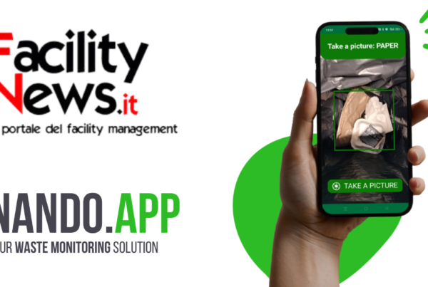
How NANDO.Sensor Delivers Volume Prediction Without Per-Bin Hardware
AI-powered computer vision on a single sentinel vehicle
NANDO.Sensor is built on the sentinel vehicle model. A single NANDO-equipped vehicle — fitted with AI-powered computer vision — maps hundreds of containers during its normal collection route. There is no hardware installation on individual bins. There are no per-unit costs scaling with the size of the container network.
The sentinel vehicle is the data infrastructure. It makes a pass, captures fill-level data at scale, and feeds that data into the optimisation engine.
Building a historical record: how the model learns your city’s rhythms
The first pass generates a baseline. The second refines it. By the fourth or fifth week, NANDO has accumulated enough data to begin identifying the fill-rate patterns specific to individual container locations — which bins in the commercial district surge on Mondays, which residential zones see elevated volumes after long weekends, which routes consistently generate underutilised collection stops.
That historical record becomes the foundation of the predictive model. The system learns the waste rhythms of a specific city, not a generic urban profile. This localisation is what drives forecast accuracy — and forecast accuracy is what drives the magnitude of the operational savings.
Predictive scheduling: which bins need emptying tomorrow vs Thursday
The practical output of the NANDO predictive model is a daily schedule recommendation: which containers need collection today, which can wait until mid-week, and how to sequence stops to minimise total kilometres driven.
Collection stops being reactive. It becomes anticipated. Drivers begin their shifts with a route already optimised against predicted fill levels — not a fixed schedule inherited from decisions made years ago.
Implementation: What It Takes to Switch From Fixed to Dynamic Routing
Integration with existing fleet management systems
NANDO.Sensor is designed to work alongside existing fleet infrastructure, not replace it. Route outputs are compatible with standard fleet management platforms. The data layer sits above current operations without requiring wholesale system replacement.
Timeline: from first data pass to optimised routes
Most deployments begin generating usable route optimisation data within the first full collection cycle. Initial recommendations are conservative — the model flags only the clearest inefficiencies while it builds confidence. By the fourth to eighth week, the historical dataset is typically rich enough to support full dynamic routing recommendations.
Common objections (and what the data says)
“We don’t have sensors on our bins.” The sentinel vehicle model doesn’t require them. One equipped vehicle generates data for the entire area it covers.
“Our routes are already efficient.” Fixed routes that feel efficient often carry significant hidden waste. A single data collection cycle typically surfaces multiple consolidation opportunities invisible to manual planners.
“The upfront cost is prohibitive.” The sentinel model converts a large per-bin hardware budget into a single vehicle deployment. The economics are structurally different from traditional sensor-based approaches.
Clients include IVECO Group, Eni Versalis, Philip Morris International, Schneider Electric, and Leonardo, groups with complex, multi-site waste compliance requirements across multiple jurisdictions.
→ See how NANDO.Sensor works in your facility — book a 15-minute plant assessment
Curious about the numbers first? Use the NANDO Cost Saving Calculator to estimate potential savings in under 2 minutes.